The Iris Chervet Studio
designs spatial structures that are
multi-scalar, anchoring each local action in its geographical context,
thick, making space for living systems and their metabolisms,
dynamic, combining different timescales and movements,
that bring together natural elements:
earth, a fertile, terrestrial base that is the anchor for human settlement
water, a free-flowing, vital fluid that hydrates the ground
air, an elemental, volatile flow that moderates climates
by orchestrating processes
that initiate progressive territorial transformations,
that regulate the inherited built environment,
that regenerate ecosystems and primary resources,
to help cultivate
environments, where plant, mineral and animal kingdoms coexist,
uses, which are adopted, adapted, interpreted and reinvented by all,
poetic meanings, whether evocative, symbolic, memorial or imaginary.
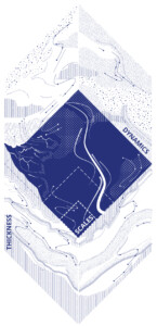
Scales
Re-embedding natural and human geographies within three scales:
- Territorial contexts
- Environments
- Uses
Weaving together these scales– from large territories to the final details – is an inherent part of the agency’s design process.
Geography is the fundamental cornerstone of urban planning and the source from which inhabited landscapes emerge. A careful, in-depth, quasi-archaeological reading of geography is a prerequisite for any project. The archaeology of a landscape lets us identify geographies which have been thwarted or erased by human activity, and then restore functional landscape systems that re-embed geographies and human uses.
The resonance between scales creates the material reality of the project: it involves creating links within the territory by transferring materials or evoking specific motifs from the local natural and cultural context. In doing so, the agency “samples” landscapes, extracts their essence and expresses their elementary components within a project.
This permanent process of iteration between different scales ensures that the overall strategic ambitions are consistent with how they are implemented at the local level.
Thicknesses
Reintegrating natural elements in three thick layers:
- the lithosphere
- the atmosphere
- the hydrosphere
Thinking of a territory in terms of its layers rather than its surfaces or borders means giving space back to living things and preserving the baseline conditions required for them to develop.
The agency’s projects restore intimate links between Earth, Air and Water: they reactivate their metabolisms and consider the surface layer of the ground as a place where natural elements encounter each other, like on skin.
This approach is both scientific and poetic: scientific, in the sense that it restores the water cycle, the biological value of the soil and the quality of the air; poetic, because it foregrounds natural elements in the ways the project is designed and materially expressed.
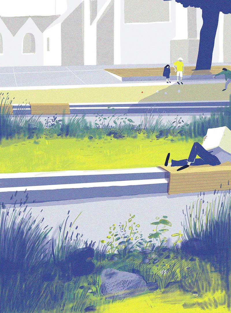
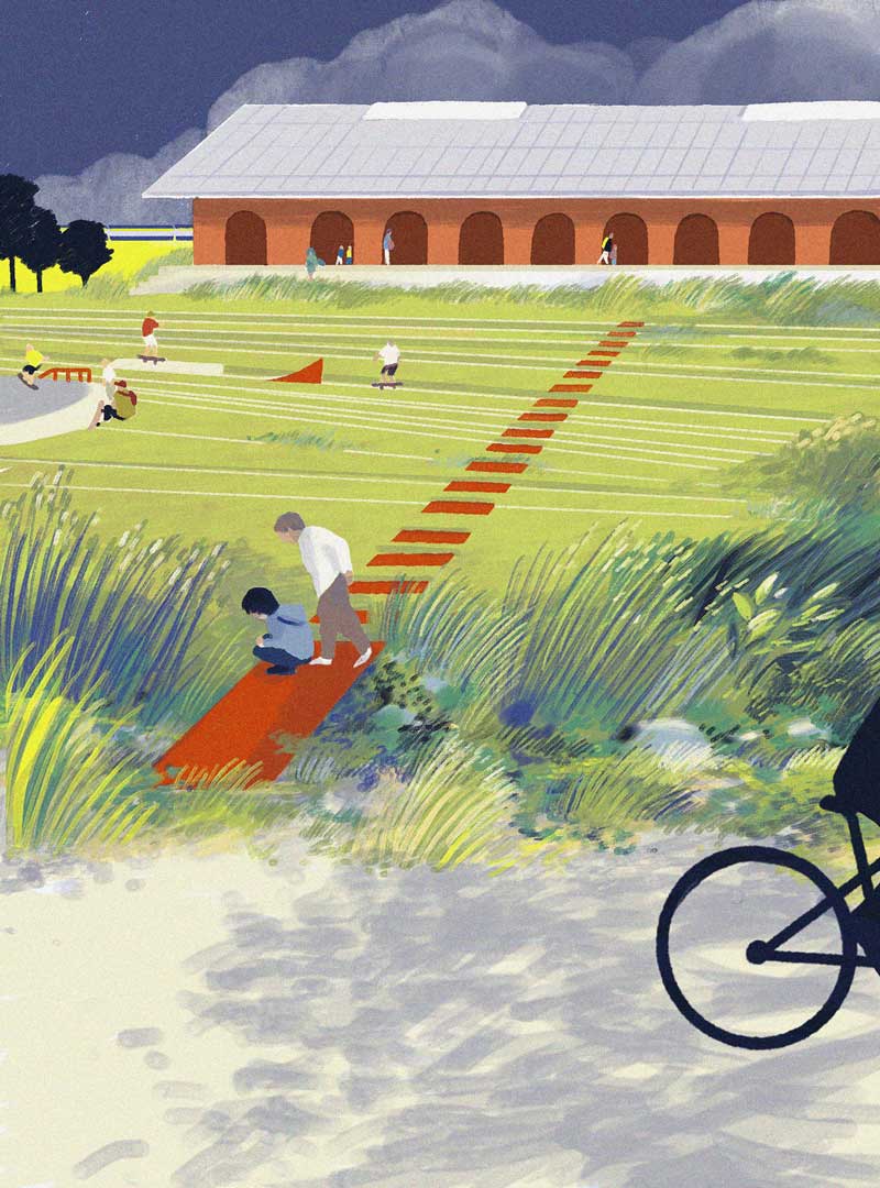
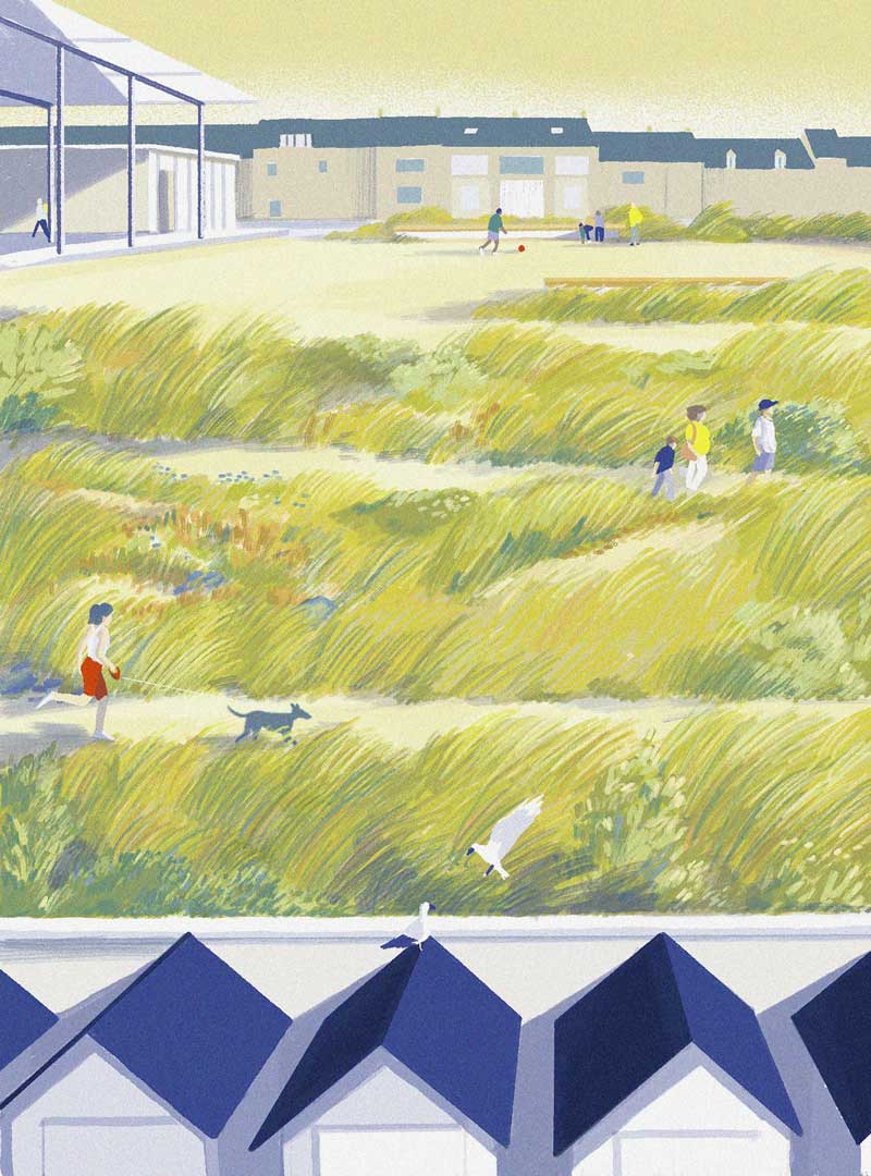
As such, these projects showcase the specificities of earth, water and air on each site, whether through geological resurgences (Saint-Brieuc), vegetation shaped by the wind (Langrune-sur-Mer) or variations on water (Saint-Omer).
Dynamics
Reactivating metabolic processes by coordinating 3 dynamics:
- time
- movements
- governance
The emergence of landscape in the design of urban environments and an increasing focus on the living world have led to the introduction of two new “project materials”: Movement and Time. The strength of a landscape design project lies in its ability to combine physical and material dimensions with time, movement and permanent adaptation. In doing so, landscape design serves as a powerful tool for territorial transformation, simultaneously initiating urban development, regulating the inherited built space and regenerating soils and ecosystems.
But landscape design is also very fragile since the coherence of a given geographical context can be undermined by a single wayward construction project. To protect and maintain spatial structures over time, we need to go beyond ensuring commitments from landscape architects and rethink the overall interplay of stakeholders and scales of governance and develop the notion of landscapes in motion.